Thursday, September 17, 2020

ROAD TRIPS OFF THE BEATEN PATH: STOPPING TO SMELL THE ROSES, OLIVES AND CHERRIES - Part One of a Series: Central Coastline Region of California©


AUTHOR'S INTRODUCTORY NOTE:  This Travelblog article was conceived and written prior to the widespread wildfires currently devastating more than 3.5-million acres in the state of California.  Our hearts and prayers go out to the residents, front line firefighters, on-site law enforcement implementing safety protocols, and courageous volunteers who every day during this nightmare and the concurrent global pandemic are putting their own lives at risk doing their best to evacuate and save other lives, homes and businesses, agriculture and livestock, pets and wildlife, schools and houses of worship, farms and ranches, historic towns and cities, California's ecosystem and its  centuries-old Redwood forests, from destruction. ~EJ  

=========================================  

One of the best ways that I have found to immerse oneself in the culture of a travel destination, short of actually living there for a while, is to take an extended road trip en route to, and around, the general region -- taking in the scenery, local history, and regional cuisine along the way.  This particularly applies to well-known, but often less-traveled, places requiring a detour off the main highway and on back roads "off the beaten path".

Overlooking Pacific Ocean near Big Sur, California
©Snobby Tours®, Inc. All Rights Reserved.

Road trips for me, both within the USA and in international locations -- always with an equally-adventurous friend or two along for the ride -- are meant to be taken at a leisurely pace without time constraints or deadlines.  Consequently, these have been, and continue to be, some of my most positive and memorable travel experiences. 

Interestingly, I ran across an article recently which focused on 10 road trips to places within the USA which are considered "off the beaten path".   One of the 10 recommended road trips mentioned, coincidentally, happens to be one of my own personal favourites -- the back roads between Los Angeles  and Santa Cruz, California, detouring off US Hwy 1/ Pacific Coast Highway, or off US Hwy 101, and where I have taken road trips numerous times over the past few decades -- during various seasons of the year -- each time discovering something new and exciting "en route" that I had not previously experienced in my travels.


Traveling north/south between Los Angeles and Santa Cruz, California, some of the highlights on my road trips along California's "back roads"  have included: 


1)    Ojai and Ojai Valley, California

        The town of Ojai, and the fertile Ojai Valley, in Ventura County, are located approximately 35 miles North of the city of Ventura, California, taking CA Hwy 33 off US Hwy 1/Pacific Coast Highway, or alternatively, from Los Angeles by taking US 101 North to CA Hwy 126 West to CA Hwy 150 North/West.  Both routes are very scenic, with Ojai being about 85 miles northwest of Los Angeles by either route.

        Ojai has for decades been known for its focus on health, wellness and spirituality, having numerous restorative spas, spiritual retreats, health/wellness centers, locally owned and operated boutique shops and B&Bs, hot springs resorts. ecologically-friendly arts/crafts, and locally-sourced organic agriculture.  Early settlers in the 1870s with respiratory problems flocked to the area because they "fared well" in the climate of the Ojai Valley -- causing Ojai's reputation to grow as a healthy place to live. One of the most famous Spas in downtown Ojai for decades waThe Oaks at Ojai, founded in 1977, and operated for over 40 years by fitness guru Sheila Cluff.  The Oaks at Ojai literally introduced "spa retreats" into public awareness.

       Ojai Valley's history is colourful and diverse.  It is a wonderful combination of farms and ranches owned by families dating back to the time of Spanish exploration and Mexican occupation, and mid-20th Century "New Age" rejuvenation and wellness spas.  

        Located on ranch land purchased in 1837 called the Rancho Ojai Mexican Land Grant, the town of Ojai can be traced back to 1874, when it was initially laid out.  It was originally named Nordhoff, after a book author who, in 1873, had touted California as a healthy living environment.  Its name, however, was changed from Nordhoff to Ojai in 1917, thought by some to possibly have been due to anti-German sentiment during WWI.  The name "Ojai" itself reaches much farther back into the area's history, and is derived from the Native American Chumash tribe's word for "moon".  The Chumash were early inhabitants of the central and southern coastal regions of what now is California.  Chumash artifacts and exquisite "cave paintings" can be found throughout the area between Malibu and Ojai, especially in caves near the foothills of the local mountain ranges. 

The Arcade on Ojai Avenue, circa 1970s 

        Ojai's cultural arts history is due in part to the influx in the early 1900s of wealthy families from the Eastern and Midwestern parts of the US, who spent their harsh winters out West in Ojai, then called Nordhoff.  One such family were the Libbeys, owners of the Libbey Glass Company in Toledo, Ohio, who arrived in 1907.  Much of the "urban landscape" of Ojai is due to Edward Drummond Libbey, who had an interest in beautifying the town, invested heavily in land on the south side of Ojai Avenue, and who brought in world-renown architects to create The Arcade (pictured above), complete with bell tower inspired by the campanile of the Cathedral of the Virgin Mary of the Immaculate Conception in Havana, Cuba.  

        Upon completion of The Arcade in 1917, the town changed its name from Nordhoff to Ojai,and established an annual celebratory "Ojai Day" which generally occurs in October.  Additionally in 1917, the land across from The Arcade was designated as Civic Center Park, later to be called Libbey Park and become the venue for the famous Annual Ojai Music Festival since its founding in 1947 and outdoor performances commenced at Libbey Bowl in the Park in 1952. 
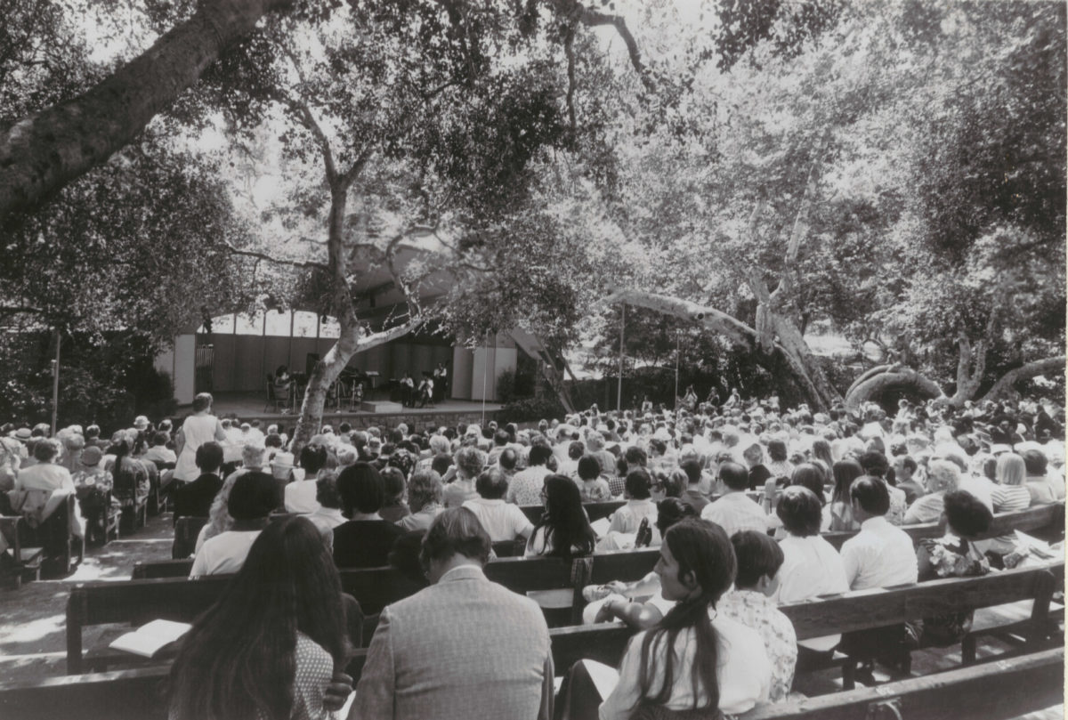
Ojai Music Festival at Libbey Bowl, circa 1960s.

        The Annual Ojai Music Festival features famous national and international Music Directors and performers, and occurs Thursdays thru Sundays during the second week of June.  The 2020 Festival was cancelled due to COVID-19 issues;  however, the 2021 and 2022 Festival Dates are anticipated to be Thursdays thru Sundays, June 10-13, 2021 and June 9-12, 2022.

2)    Santa Barbara County and Los Olivos, California

        CA Hwy 154 between Solvang, California and Santa Barbara, California has some of the prettiest stretches of back roads which I have driven in that State.  Santa Barbara County has over 300 wineries, perfect for "winery-hopping" in the Santa Ynez Valley, with many providing tours of their facilities and wine-making processes.  Los Olivos, is a small, unincorporated community of just over 1,000 residents in northeastern Santa Barbara County known for its olive groves and olive oil production -- and the 2004 feature film, "Sideways".  

        While in the city of Santa Barbara before taking the back road north along CA Hwy 154 North to Los Olivos, I always first have to take a little detour to the expansive and spectacular Rose Garden located at the Santa Barbara Mission -- literally, to "stop and smell the roses". 

Mission Santa Barbara Rose Garden
©Snobby Tours®, Inc. All Rights Reserved.

        Known today as the A.C. Postel Memorial Rose Garden, but more commonly referred to as "The Rose Garden", it is located on land adjacent to the Santa Barbara Mission formerly owned by the Mission.  The city of Santa Barbara purchased the land in 1928.  In 1955, The Rose Garden was first planted with 500 donated rose bushes.  In 1962, the Santa Barbara Rose Society received permission from the City to sponsor The Rose Garden.  Today, it contains over 1,500 rose bushes of different varieties and colours which bloom primarily between April and November each year, and is a favourite place of locals as well as travelers.  It is also one of around 130 "demonstration" rose gardens throughout the USA which display top-performing new varieties of roses.  

       The section of CA Hwy 154 between the southern region of Santa Barbara County and Los Olivos is quite interesting, because along this back road there are miles of well-maintained ranches with white picket fences along the way which are home to farms breeding miniature horses and large ranches for breeding Arabian thoroughbreds.

Miniature horse farm along Hwy 154
©Snobby Tours®, Inc. All Rights Reserved.

        Wine tastings and olive oil samplings are a "must do" when visiting Santa Barbara County and Los Olivos -- in fact, so much so that both activities have become firmly entrenched in today's "travel culture".  

        Los Olivos is located at the north end of Santa Barbara County, off US Hwy 101 by taking CA Hwy 154 North/San Marcos Pass Road at Ventura, California for approximately 65 miles. It is also easily accessed from US Hwy 1/US Hwy 101 staying on US Hwy 101 North after these two US highways split, and traveling through Buellton and Solvang, California -- a total of about 75 miles from Ventura, California.  Either way, the scenery as one gets into the Santa Ynez Valley and nearby mountain range is beautiful, especially in the Spring and Fall of the year.          

        In many ways, the history of Los Olivos is typical of the settlement of California in the mid-to-late 1800s following the Civil War, with persons from the Eastern and Midwestern parts of the USA coming to California to escape harsh winters, or who were lured by the California Gold Rush.  

        In 1880, 22-year-old Alden Marsh Boyd from Albany, NY bought 157-acres of fertile farmland and the dwelling house thereon.  In 1885, he planted 5,000 olive trees, and named his place, Rancho de Los Olivos.  Since olive trees generally live for about 500 years, it's safe to say that most of Boyd's original olive trees dating back to the 1880s are still alive today, and can be seen throughout the area.

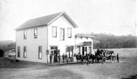
        The railroad and the stagecoach came, and the town thrived. The southern terminus of the railroad stopped in front of Mattei's Tavern, established in 1886, which became a popular stagecoach stop during the California Gold Rush.  Mattei's Tavern still operates in downtown Los Olivos as a restaurant and inn today. 

Vintage photo of Mattei's Tavern and Inn

        These days, in addition to wine-tasting rooms, Downtown Los Olivos is filled with art galleries, upscale shops, quaint Victorian houses used for residences and small businesses, and restaurants serving locally-sourced agriculture prepared in in the manner which has become known as "California cuisine".  In addition to the vast expanses of olive groves now are also lavender fields and fruit orchards.  

        Los Olivos also holds an Annual Jazz and Olive Festival in early June, where visitors can sample wine from over 30 nearby wineries, enjoy the music of world-class jazz musicians, and try 30 different "olive-themed" dishes prepared by local "O Chefs".  

        This event, first held back in 2004, is sponsored by the Los Olivos Rotary Club and raises funds for local nonprofit organizations. 

        The Scarecrow Festival is another annual event.  Held throughout the month of October each year, local residents and businesses compete for the "best scarecrow" in a number of categories, such as scariest, most humorous, all "naturally-constructed", and even most representative of a type of business.  


3)     Castroville, California

        Castroville, California in Monterey County, is known as "the Artichoke Center of the World".   Castroville, population around 6,500, is located approximately 11-miles North of Salinas, along CA Hwy 183. 

        California's artichoke history began in 1922 when the first artichoke shoots were planted in Castroville.  Today, nearly 100% of the USA's artichoke supply comes from California, with about 2/3rds of that supply being grown in the small town of Castroville. 

        In 1948, Norma Jean Mortenson (birth name) was crowned California's very first Artichoke Queen.  A few years later, she was better known as Marilyn Monroe.

An Artichoke Ranch in Castroville, circa 1976

        Castroville's  Annual Artichoke Festival has been a "local fixture" for over 60 years.  Begun in 1959, its mission has been to celebrate the artichoke by exciting the public about the farming, harvesting and preparation of artichokes, and in doing so, raising funds to support Castroville-area nonprofit organizations which provide services for local Seniors, student educational enrichment programs, and parks/recreation facilities.  The Festival is generally held around the end of May/first of June each year, and is anticipated to occur next year the weekend of June 5-6, 2021.


4)    The original Casa de Fruta in Hollister, California

        Hollister, California is approximately 50 miles southeast of Santa Cruz, California, taking US Hwy 1 South to CA Hwy 129 East merging into CA Hwy 156 East and then taking FM 1568 East.  Hollister is also approximately 250 miles north of Santa Barbara, California, taking US 101 North to CA Hwy 156 East and then taking FM 1568 East.

        The first orchards which led to the establishing of Casa de Fruta were planted in 1908 in what now is Santa Clara County.  The name is Spanish for "House of Fruit".  Casa de Fruita began as the family business of an Italian immigrant family, the Bisceglia brothers, as a stop for locals and travelers along a roadside just west of the Merced County line in the fertile Pacheco Valley between Monterey and Yosemite.  The original location was well known to Native Americans living in the region, and was first documented in the 1790s by Spanish missionaries after an artesian well was discovered there.  Later in the 1850s, the well was a water source during the California Gold Rush.         

        In the 1943, three teenaged grand-nephews of the  Bisceglia brothers established a fruit stand selling fresh-picked cherries about 10-miles northeast of Hollister on what now is called Pacheco Valley Pass.  It can be visited by taking FM 1568 North, merging into CA Hwy 156 North from the town of Hollister.  It is at this location that the business flourished and expanded during the following decades into the multi-faceted enterprise that it is today, still owned and operated by Bisceglia family descendants.

Original Casa de Fruta fruit stand in Hollister, CA

        The original Casa de Fruta fruit stand still exists, and continues to provide travelers along the Pacheco Valley Pass/CA Hwy 152 with an impressive selection of locally-sourced fruits (fresh and dried), vegetables, nuts and condiments.  

        To me, it's a "local historical treasure".

==========================================

AUTHOR'S CONCLUDING NOTE: I've shared in this Travelblog article just a few of my favourite "off the beaten path" places in California,  focusing primarily on the central coastline region between Santa Barbara and Santa Cruz.  There are SO many more memorable places which I discovered over the decades that I lived full time in California, but I simply could not include all of them in this single article.  At the time of publication, however, each of the places I have mentioned in this article is in jeopardy from the widespread devastating wildfires, still out of control.   In these extraordinarily challenging times, and during these concurrent unspeakably heart-breaking crises, I'm sending all of my family, friends and colleagues living in California my thoughts and prayers that you and yours will be safe and stay well.  You all hold a special place in my heart.  ~EJ


© 2020 Snobby Tours®, Inc. All Rights Reserved.


Friday, August 21, 2020

CRYSTAL BRIDGES MUSEUM OF AMERICAN ART: TWO EXHIBITS SHOWCASING ITS OWN NATURAL SETTING IN THE OZARKS AND PHOTOGRAPHER ANSEL ADAMS©


It's no secret that Crystal Bridges Museum of American Art in Bentonville, Arkansas is a favourite destination of mine, and of travelers on our "Presidential Libraries and Fall Foliage of the Midwest©" Tour.  

This Fall, Crystal Bridges will present two Special Exhibits -- both celebrating the American landscape:  1)  "Ansel Adams in Our Time" and 2) the return of "North Forest Lights".

The Museum and both Exhibits will have enhanced safety measures in place due to COVID-19 concerns.


1)    "Ansel Adams in Our Time"

        I had the opportunity to meet Ansel Adams and his wife years ago in Los Angeles at an event held in one of the art galleries along the famed La Cienega Blvd., at a time when some of those art galleries and the artists exhibiting therein were becoming legendary.  Adams had spent time in Los Angeles decades earlier in late 1940 as a young photographer on assignment with Fortune magazine.  He had a jovial personality, twinkling blue eyes, snow white hair and a full beard, and when I shook his hand, I noticed how smooth and soft his palm was from his many years working with the chemicals he used to develop his black-and-white photographs.   

        The Wall Street Journal describes the Exhibit "Ansel Adams in Our Time" in the following way: "America's most famous nature photographer is given a new context". 

        For over 50 years, Ansel Adams captured the breathtaking beauty of the United States in stunning black-and-white photographs containing images of a time gone by, frozen in time.  


        This Special Exhibit features more than 100 of Adams' most iconic works like never before, displayed alongside 19th Century photographers and contemporary artists who both influenced  -- and who were influenced by -- this legendary American artist. The history and production of pre-digital photography is also explored.

        Visitors will move back and forth in time viewing national parks, the American Southwest, as well as desert and wilderness scenery as captured by Adams' lens, and also by 24 of his contemporary successors, some of whom have expressed environmental concerns which stem from Adams' legacy.  

        "Ansel Adams in Our Time" runs from September 19, 2020 through January 3, 2021, and was originally organized by the Museum of Fine Arts, Boston.


2)    "North Forest Lights"

        Crystal Bridges Museum is literally situated in an idyllic setting within the spectacular Ozarks and with plenty of surrounding land for outdoor art installations, the relocation of Frank Lloyd Wright's Bachman-Wilson House, and nature trails.

        "North Forest Lights" returns for a second season in Crystal Bridges' North Forest, where visitors will again enjoy an enchanted nighttime stroll through the Ozark woods featuring five separate installations that will bring the forest to life with dynamic, nature-inspired lighting elements, sensory effects, and immersive soundscapes which merge with nature's own "music" into a unique symphony of light and sound engaging for the entire family.

        To create this symphonic "concert", Crystal Bridges partnered with Montreal-based multimedia and entertainment studio, Moment Factory. 

        "North Forst Lights" opens on September 4, 2020 and continues through April 4, 2021.  It can be visited each week in the evening hours after sunset, Fridays through Sundays.  Additional days may be offered later in the season.


SIDE NOTE:  Crystal Bridges Museum of American Art is included as a featured stop in the Itinerary of our custom-created escorted group heritage Tour, "Presidential Libraries and Fall Foliage of the Midwest©.  For more information about this fun and interesting Tour, link to our Website at:  http://snobbytours.com/PrezLibMidwestFFChicago.html


(Primary Source:  Crystal Bridges Museum of American Art)

©2020 Snobby Tours®, Inc.  All Rights Reserved.

Tuesday, August 4, 2020

NOTRE DAME CATHEDRAL'S GRAND ORGAN: SURVIVING THE FIRE AND BEING REFURBISHED TO PERFORM DURING THE 2024 OLYMPICS IN PARIS©


When fire ripped through the over 900-year old Notre Dame Cathedral in Paris on April 15, 2019, the world literally looked on in horror.  


Much was lost which can never be replaced, including beautiful artisan-crafted stained glass windows, and it has taken more than one year to get rid of the toxic lead residue left by the fire. Traces of the hazardous lead dust have even shown up in honey produced by Parisian beehives since the fire.


Lead was a highly used building material in Paris during the time of the construction of Notre Dame, built in the 12th Century. The roof and the spire of the cathedral had several hundred tons of lead and while most melted during the fire, some flames reached temperatures high enough to aerosolize lead oxides.

  
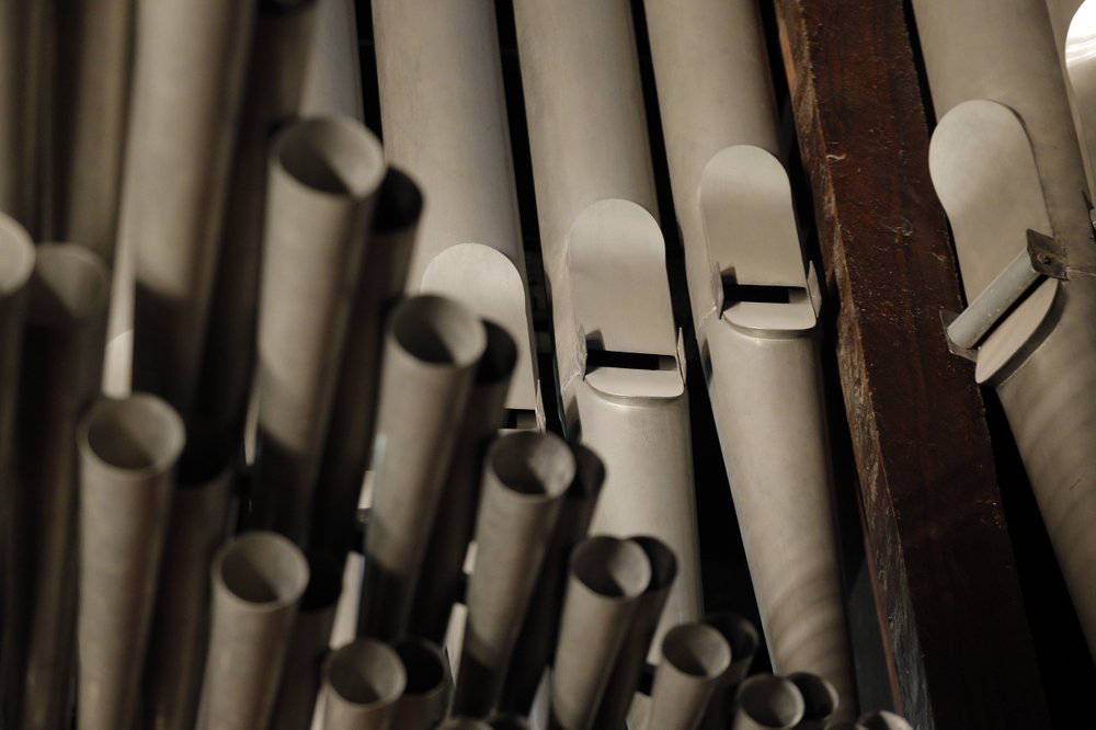
Amazingly, the 8,000-pipe Grand Organ, which dates back to 1733, survived the fire which consumed the cathedral’s roof and toppled its spire; however, the blaze coated the instrument in the toxic lead dust that must now be painstakingly removed.


Although the Grand Organ itself didn’t burn, it also suffered additional damage from the record heatwave that followed the fire during last summer, and has been affected by other temperature variations to which it has been exposed since the Cathedral lost its roof.


Pipe by precious pipe, the Grand Organ that once thundered through Notre Dame Cathedral is being taken apart. The mammoth task of dismantling, cleaning and reassembling France’s largest musical instrument began on Monday, August 3, 2020 and is expected to last nearly four years.  


Experts have started removing the organ’s keyboards and will then take out its pipes through the end of this year, according to the reconstruction agency. The pieces will be placed in special containers inside the huge Cathedral, where the cleaning and restoration will take place.


Once restored, it will take six months just to tune the organ, according to the state agency overseeing Notre Dame’s restoration. 


Notre Dame Cathedral itself is currently closed to the public; however, France's President Emmanuel Macron hopes the Cathedral can reopen in time for the 2024 Summer Olympics in Paris.


The music of Notre Dame's Grand Organ, however, is scheduled to resound again through the much-loved medieval Paris monument on April 16, 2024, marking five years since the fire. 

The Cathedral's organist Johann Vexo is already dreaming of that day.

“It’s a very powerful organ, but with also a lot of poetry,” said Vexo, who was playing the organ during an evening Mass when the fire alarm sounded on April 15, 2019. “It’s just probably the most beautiful organ in the world.”


(Reference and Photo Sources: The Associated Press; Eric Mack, Contributing Writer (Science), Forbes Media; Cecelia Rodrigues, Senior Contributor (Arts), Forbes Media; Environmental Letters Jourmal)

©2020 Snobby Tours®, Inc.  All Rights Reserved.


Saturday, July 18, 2020

THE KING RANCH LEGACY IN TEXAS©


Captain Richard King’s domesticated longhorns, located on his vast South Texas Ranch of around 146,000 acres back in 1867, were some of the very first hoof stock to comprise the early northward Texas cattle drives.  

Getting these cattle to market was a real challenge, though, as some one thousand miles of dangerous wilderness stretched out between Captain King’s cattle and the midwestern railheads where they could be sold.

From 1867 to1884, the Chisholm Trail was the major livestock route out of Texas, during the "Beef Bonanza", traveling north to Kansas from the expansive King Ranch in South Texas.

From Texas State Historical Association: “Cattle drovers followed the old Shawnee Trail by way of San Antonio, Austin, and Waco, where the trails split. The Chisholm Trail continued on to Fort Worth, then passed east of Decatur to the crossing at Red River Station. It followed the same route as modern U.S. Highway 81 from Fort Worth to Newton, Kansas.”


King's Running W brand was first registered in 1869.  Some have said that it represents one of the ranch’s many diamondback rattlesnakes or the Santa Gertrudis Creek, while others are sure it signifies the sweeping horns of a Texas Longhorn bull. 

The Waco Suspension Bridge built during this time period, was constructed across the Brazos River for the primary purpose of moving cattle along the Chisholm Trail.

Captain King died in 1885, right after this period ended, but not before he had turned his efforts towards raising cattle in South Texas.


During the early 1900s, King Ranch made its name in animal husbandry. By crossbreeding Brahman bulls, native to India, with British Shorthorn stock, the ranch produced the Santa Gertrudis, recognized as the first American breed of beef cattle and the first cattle breed to be recognized in the world in more than a century. This breed of cattle continues to be recognized throughout the world for its fine beef quality and ability to withstand arid climates. Today, the Santa Gertrudis is the most prevalent cattle breed in Australia.

The "King Suite" at the historic Menger Hotel in San Antonio, is named after Captain King who stayed there frequently. As legends go, it is thought that he is still occupying that room, long after his death -- not surprising, since the Menger Hotel has a number of famous and infamous "residents" who have been "seen" wandering the hallways both day and night, and even sitting in one of the Menger's two Lobbies.

Conversely, although the dish known as the "King Ranch Casserole" may have been named for the King Ranch, the origin of the casserole is unclear, AND the King Ranch does not claim it.  (Besides, the casserole is made with chicken, not beef, and the King Ranch is known for beef, not chickens.)

Today, the King Ranch remains a thriving multi-faceted agribusiness enterprise, which offers daily tours and an onsite Museum.   It is still family-run by 6th generation decendants of Captain King, and all of the quarter-horses on the Ranch are descendants of King's own sorrel. For more info, link to: https://king-ranch.com/


Primary Research Source:  The King Ranch
©2020 Snobby Tours®, Inc.  All Rights Reserved.

Thursday, July 2, 2020

THE NATIONAL ARCHIVES IN WASHINGTON, D.C. - A NATIONAL TREASURE©


While serving in office from 1933-1945, President Franklin D. Roosevelt, often referred to as "FDR", inventoried the vast quantities of papers and other materials he and his staff had accumulated. Up to that time, many Presidential papers and records had either been lost, destroyed, sold for profit, or ruined by poor storage conditions.

President Roosevelt sought a viable solution.  Advised by a number of noted historians and scholars, he established a public repository to preserve the evidence of the Presidency for future generations.

In Roosevelt’s own words: “To bring together the records of the past and to house them in a building where they will be preserved for the use of men and women of the future, a Nation must believe in three things.  It must believe in the past.  It must believe in the future.  It must, above all, believe in the capacity of its own people to learn from the past so that they can gain judgment in creating their own future”.

Prior to the establishing of the National Archives, records created by the Federal Government lacked a stable and secure environment and were not easily accessible to the public. In 1926, during the Presidency of Calvin Coolidge, the US Congress passed the Public Building Act, providing for the construction of several government buildings including "a National Archives".


Architect John Russell Pope was selected to design the building, and ground was broken on September 5, 1931, during the Presidency of Herbert Hoover. On February 20, 1933, President Herbert Hoover laid the building’s cornerstone.

In 1934, after Franklin D. Roosevelt had been elected President, the US Congress voted to establish the National Archives to preserve and care for the records of the U.S. Government.   Prior to that time, Federal records were kept in various basements, attics, abandoned buildings, and other storage places with little security or concern for storage conditions.  On June 19, 1934, with the building’s construction well under way, President Franklin D. Roosevelt signed legislation creating the National Archives and authorizing it to collect, care for, and make available Federal Government records. 

President Roosevelt appointed Robert D.W. Connor as the first Archivist of the United States, and 80 staff members moved into the nearly-completed building in the Fall  of 1935, ready for the daunting task of surveying and restoring historical Federal records. 


The agency’s first order of business was locating records.  Archives staff surveyed records located in the Washington, D.C. area, while the Works Progress Administration (WPA) workers surveyed Federal records nationwide  The following year, in 1936, the first batch of Federal records were transferred to the new National Archives Building in Washington, D.C.

Staff found records in basements, attics, carriage houses, abandoned buildings, and alcoves.  Many  records had suffered from neglect, infestations, water damage, and even theft.  Records transferred to the National Archives initially went to the Document Conservation Lab to be fumigated.  Thereafter, they were cleaned with specially designed air guns.

The sheer volume of Federal records being located was massive.  Almost as soon as the National Archives building had opened, it required renovation to make room for the influx of records. The inner courtyard was altered and filled with stacks -- doubling the records storage space.

The architect Pope had specifically designed the National Archives’ 75-foot-high “Exhibition Hall” to display the Declaration of Independence and the US Constitution. The Hall included large murals by artist Barry Faulkner depicting the creations of these documents, and a “shrine” designed to hold the original documents. Despite this, however, the Charter documents remained located at the Library of Congress for almost 20 more years.

Finally, in April of 1952, the US Congress ordered that the originals of the Declaration of Independence and the US Constitution be moved to the National Archives.
These "Charter Documents" were transferred in a solemn public ceremony, pictured here, on December 13, 1952, and unveiled to the public on Bill of Rights Day, December 15, 1952.

Falling under the umbrella of the National Archives are most of the Presidential Libraries, with the exception of the Abraham Lincoln Presidential Library and Museum in Springfield, Illinois, which is run by the State of Illinois.  

In 1938, President Franklin D. Roosevelt proposed the very first Presidential Library, to be built with private funds, containing all the records of his administration, and to be run by the National Archives.  Congress approved FDR’s plan, and his Library opened during his Presidency in 1941 in Hyde Park, NY.


All of FDR’s Presidential successors, as well as his immediate predecessor, Herbert Hoover, have perpetuated this tradition.   Because the original legislation approved by Congress had pertained only to FDR, Congress passed the Presidential Libraries Act in 1955, paving the way for Presidential libraries, papers, and memorabilia to be allowed to be transferred to the National Archives.


President Harry S. Truman
at Truman Presidential Library
Independence, Missouri


Dwight D. Eisenhower
Presidential Library
Abilene, Kansas


Lyndon Baines Johnson Presidential Library
Austin, Texas


Ronald Reagan Presidential Library
Simi Valley, California


Herbert Hoover Presidential Library
West Branch, Iowa

After Watergate and President Richard Nixon’s resignation in 1974,  the US Congress passed legislation seizing Nixon’s materials and mandating that the National Archives process them for public access.

Congress later passed the 1978 Presidential Records Act, which designated Presidential papers as "government property that must be transferred to the National Archives at the end of an administration".  Ronald Reagan was the first President required to comply with the Act.

Most recently, President Barack Obama created a new model for his library whereby NARA will not administer a Museum nor a traditional Presidential Library, but will instead focus on preserving and making accessible Obama’s Presidential records digitally.

Over the years, the National Archives gained new responsibilities relevant to current as well as historical Federal records, leading to its name eventually being changed to the National Archives and Records Administration (NARA).

From one building on Pennsylvania Avenue back in 1935, the National Archives now oversees more than 40 facilities nationwide. 

Today, the mission of the National Archives is to provide public access to Federal Government records in its custody and control.  In the furtherance of this mission, the Archives state: “Public access to government records strengthens democracy by allowing Americans to claim their rights of citizenship, hold their government accountable, and understand their history so they can participate more effectively in their government”.


NOTE:  Presidential Libraries are the focus of two of our "Around the USA" custom-created escorted group heritage tours.  For more information about, and to book, either or both of these interesting, educational and fun tours, link to our Website at:  Presidential Libraries in the Lone Star State of Texas©  and to  Presidential Libraries and Fall Foliage of the Midwest©.


===================================


(Primary Research Source:  The National Archives and Records Administration)
©2020 Snobby Tours®, Inc.  All Rights Reserved.